
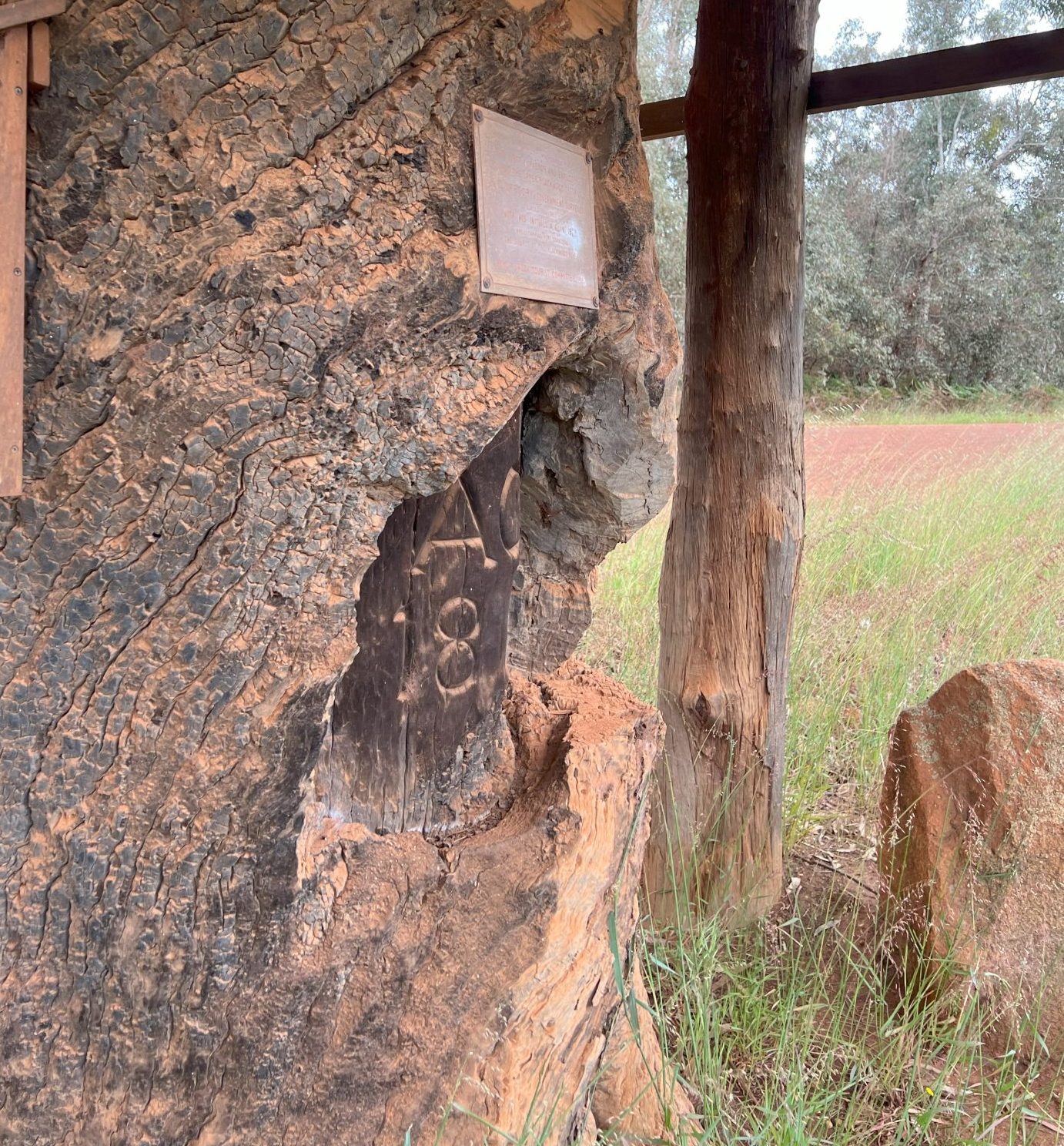
The initial exploration of the Boyup Brook area (then known as the ‘Upper Blackwood’) was marked by a surveyor’s benchmark cut on this tree by Assistant Surveyor A. C. Gregory (1819-1905) during his first journey through the Blackwood district.
Although accounts of Gregory’s exploration trips to the Blackwood are mostly vague, it is quite evident that during his first journey he did do exploration work in the Upper Blackwood. Evidence of his visit still exists in what is termed the “Gregory Tree”. This tree stands near the Blackwood River on the side of Gibbs Road midway between the township of Boyup Brook and locality of Dinninup. On this tree Gregory cut his name and the year 1845. In searching through records of Gregory’s travels no reference to this tree could be found, but it is quite evident that he crossed the Blackwood River at this point.
This benchmark was found by H. S. Ranford during surveys 32 years later in May 1877. Despite the tree being a Jarrah, the blaze had already begun to deteriorate, leading Ranford to record it as “AG over 1843”, though he queried the ‘3’.
In the many years following the finding by H.S. Ranford the tree has died and suffered much deterioration, including fire damage resulting in the last two numerals being indecipherable.
In 1983 the Boyup Brook Tourism Committee gained permission to remove the top of the tree and protect the stump under a roof. A bronze plaque was attached with the following information:
Much discussion and debate has claimed the attention of local historians and organisations interested in the actual date that Gregory travelled through the area and marked the tree.