
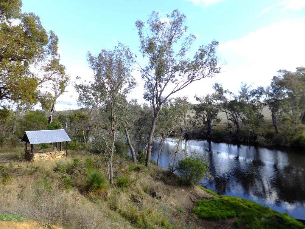
Winnejup Reserve is situated 15kms due east of Bridgetown on the eastern bank of the Blackwood River, at the Winnejup Road Bridge. It covers an area of 27.38 ha, with approximately 1.6 km of river frontage and a variety of trails.
Winnejup Reserve had an important place in the history of the Winnejup community, being the site of the original Winnejup School, which opened in April 1908. When the school closed in 1943 and moved to Bridgetown, the old school hall continued to be used as a church and recreational meeting place until it was demolished in 1985. Today, only the hall’s foundations remain.
For over 100 years, building sand was removed, leaving an extensive sand pit which was revegetated in 1995 to create a native seed orchard. Unfortunately frequent burning of the reserve has encouraged Perennial Veldt Grass, which is an extensive weed throughout the reserve.
Although small, Winnejup has conservation value for the variety of habitats and over 120 plant species that are represented within its boundaries. Flooded Gums, with an understorey of Tea Tree and Swamp Paperbark thickets, fringe the long river pool. The plant community of the high rocky outcrop is in condition and includes White Myrtle, Verticordia, Cowslip Orchids, Common Donkey Orchids and the Jug Orchid. Sweet Quandong, Santalum acuminatum, occurs on the shallow soils of the rocky outcrop, next to the walk trail. This tall shrub to small tree is summer flowering, with bright red edible fruit being present from late winter to spring. It is an uncommon plant in our area and a close relative of Sandalwood.
The reserve supports “old growth” Jarrah, the hollows in which are suitable nesting sites for animals such as possums, cockatoos and owls. The endangered Baudin’s Cockatoo and Forest Red-tailed Black Cockatoo, the Masked Owl and Brush-tailed Possum have been observed in the reserve. The Honey Possum, Pygmy Possum, Brush-tailed Phascogale and the Quenda are also likely to occur in this area.
Pick up a Walk Trails booklet from the Visitor Centre which has a map and more information about the walks.